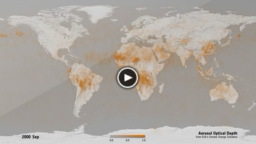
Aerosol Optical Depth
Aerosol are airborne solid particles or liquid droplets that remain in suspension in the atmosphere for
several hours and can have either natural or anthropogenic origin. The CCI Aerosol project provides
long-term records of global aerosol properties such as aerosol optical depth (AOD), stratospheric
aerosol extinction profiles and other information on aerosol type.
|
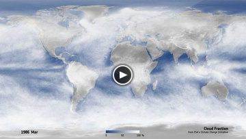
Cloud Fraction
Clouds are formed from the condensation of water vapour on the surface of aerosol particles and,
depending on their type, clouds have a warming or a cooling effect on Earth. The CCI Cloud project
produces long-term coherent cloud property datasets such as cloud mask/fraction, cloud phase, cloud top
pressure/height/temperature, cloud optical thickness, cloud effective radius and cloud liquid/ice water
path.
|
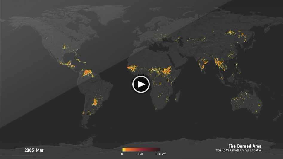
Fire Burned Area
Wildfire is uncontrolled fire that occurs in natural landscapes (e.g., frost, grassland, savannah) and
rural areas. The CCI Fire project aims to improve the consistency of burned area detection products at
global scales such as sum of burned area and fraction of burnable area.
|
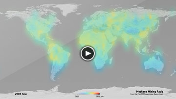
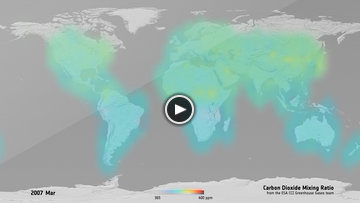
Greenhouse Gas CH4 mixing ratio
Carbon dioxide (CO2) and methane (CH4) naturally occur in the Earth's atmosphere as trace gases, but
their concentrations have increased in recent years due to human activities. They are both greenhouse
gases (GHG) and main drivers of global climate change. The CCI GHG project provides column-averaged
dry-air mole fractions (molecular mixing ratios) of CO2 and CH4, denoted XCO2 and XCH4, respectively.
|
Greenhouse Gas CO2 mixing ratio
Carbon dioxide (CO2) and methane (CH4) naturally occur in the Earth's atmosphere as trace gases, but
their concentrations have increased in recent years due to human activities. They are both greenhouse
gases (GHG) and main drivers of global climate change. The CCI GHG project provides column-averaged
dry-air mole fractions (molecular mixing ratios) of CO2 and CH4, denoted XCO2 and XCH4, respectively.
|
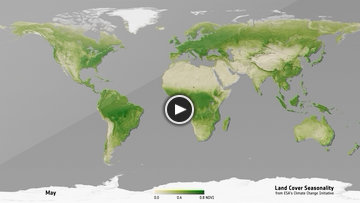
Land Cover Seasonality NDVI
Land cover is defined as the (bio)physical cover of the surface of the Earth including grass, trees,
bare ground and water. The CCI Land Cover project provides a harmonised, stable and consistent account
of long-term land cover status and change at global scale.
|
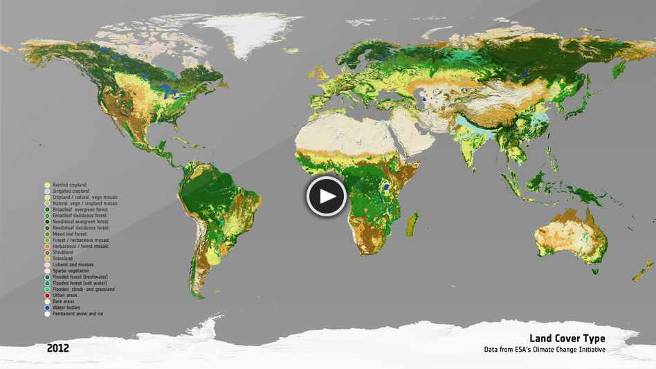
Land Cover Type
Land cover is defined as the (bio) physical cover at the surface of the earth surface including grass,
trees, bare ground and water. Land cover is fundamental to better understand the climate through the
estimation and validation of fluxes of water, carbon, and energy. It plays a role in adaptation and
mitigation assessments at various scales. The CCI Land Cover project aims to generate the longest possible
global land cover map series that is temporally consistent and based on multi-mission EO instruments.
|
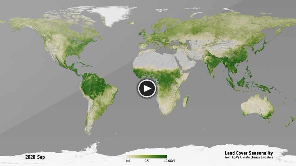
Land Cover Seasonality OGVI
Land cover is defined as the (bio)physical cover of the surface of the Earth including grass, trees,
bare ground and water. The CCI Land Cover project provides a harmonised, stable and consistent account
of long-term land cover status and change at global scale.
|
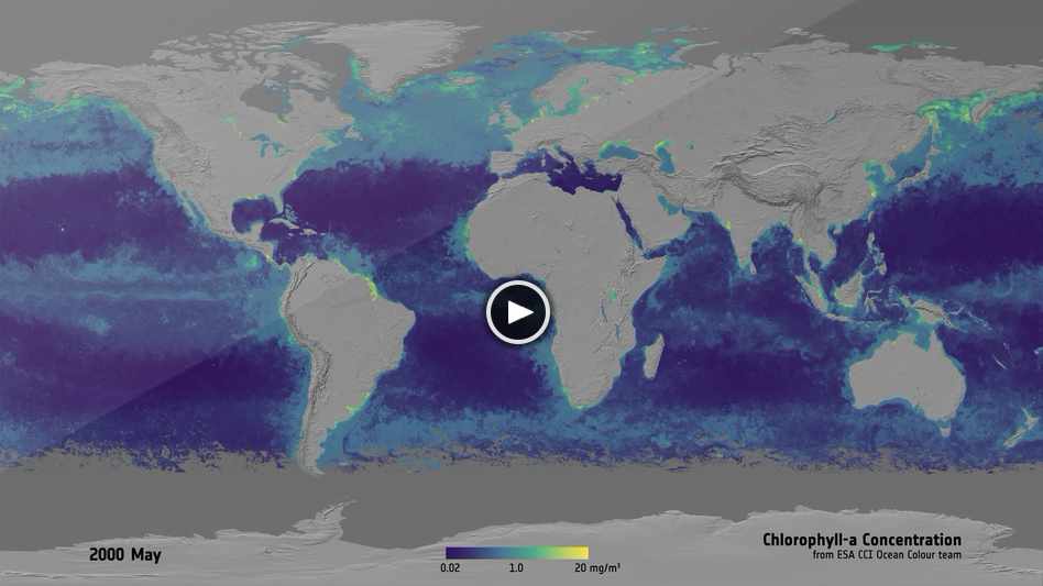
Oceancolour Chl-a Concentration
The colour of the oceans (or ocean colour, OC) is determined by interactions of incident sunlight with
substances or particles present in the water such as phytoplankton and suspended sediment. The CCI OC
project combines observations from multiple satellite sensors to provide consistent and long-term ocean
colour data globally.
|
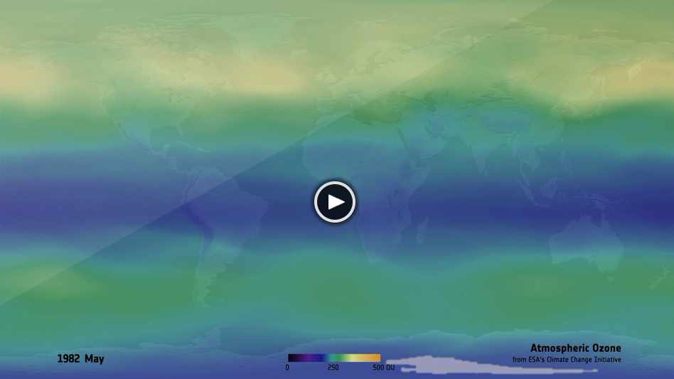
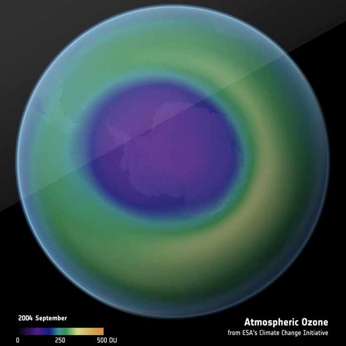
Atmospheric Ozone Concentration
Ozone is a highly reactive gas in the atmosphere with both natural and antropogenic origin. The CCI
Ozone project merges ozone profile data from several instruments to create a long-term, harmonised and
consistent total ozone column dataset.
|
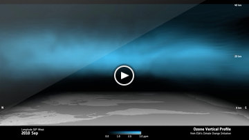
Ozone vertical profile
Ozone is a highly reactive gas in the atmosphere with both natural and antropogenic origin. The CCI
Ozone project merges ozone profile data from several instruments to create a long-term, harmonised and
consistent total ozone column dataset.
|
Ozone annual minima
Ozone is a highly reactive gas in the atmosphere with both natural and antropogenic origin. The CCI
Ozone project merges ozone profile data from several instruments to create a long-term, harmonised and
consistent total ozone column dataset.
|
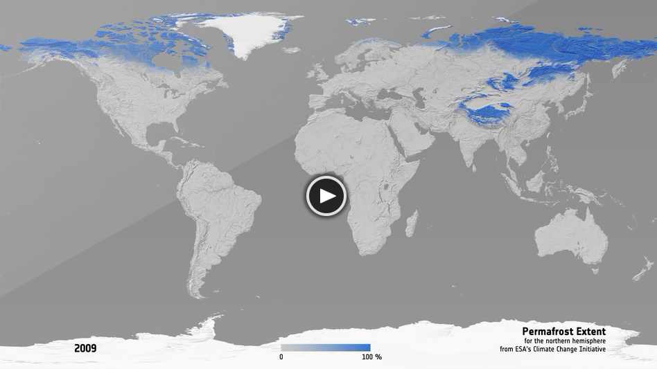
Permafrost extent
Permafrost is ground that continuously remains below 0°C for two or more years. The CCI Permafrost
project produces datasets on permafrost extent and fraction (distinguishing isolated (0-10%) sporadic
(10-50%), discontinuous (50-90%) and continuous permafrost (90-100%)), active layer thickness and
permafrost ground temperature.
|
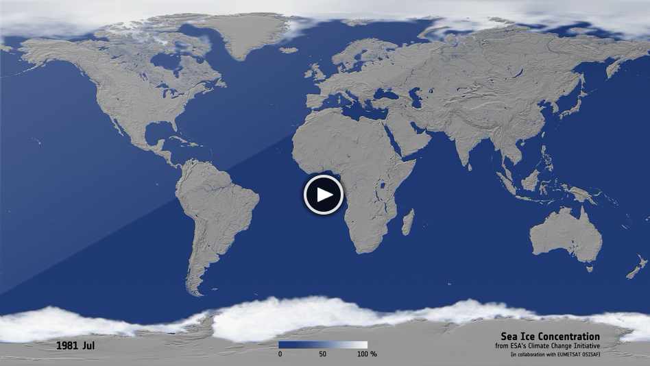
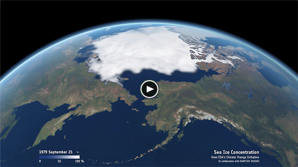
Sea Ice Concentration
Sea ice is formed when seawater freezes and because of its lower density than seawater, sea ice floats
on the ocean's surface. The CCI Sea Ice project generates long-term global sea ice thickness and sea ice
concentration products.
|
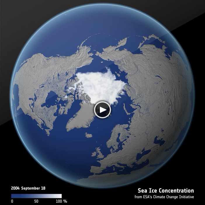
Sea Ice Annual Minima
Polar sea ice is both an indicator and a driver of global climate change. We now have over 40 years of
satellite data (since the late 1970s) to directly monitor its evolution in concentration, area and extent.
The CCI Sea Ice project aims to advance the retrieval capability for two main variables: sea ice
concentration and sea ice thickness.
|
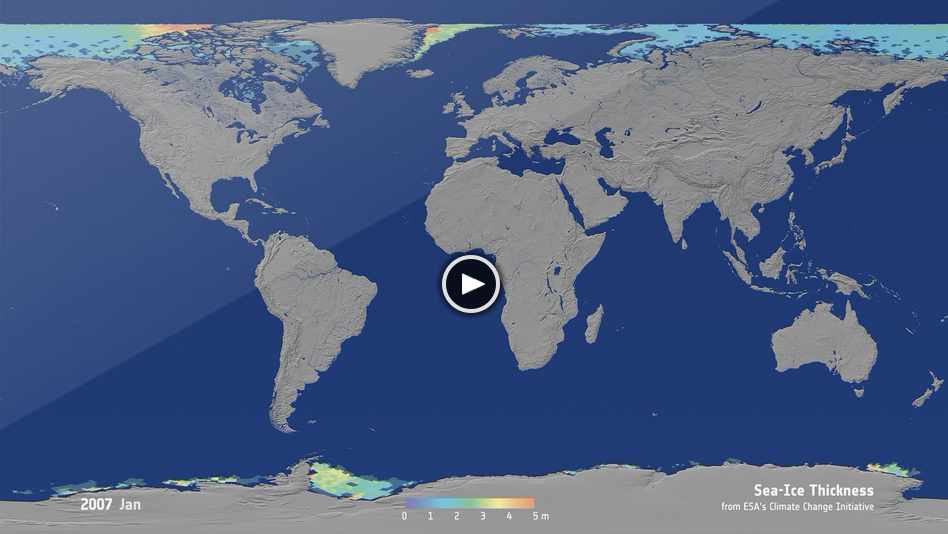
Sea Ice Thickness
Polar sea ice is both an indicator and a driver of global climate change. We now have almost 30 years of
satellite data (since the early 1990s) to monitor its evolution in thickness. The CCI Sea Ice project aims
to advance the retrieval capability for two main variables: sea ice concentration and sea ice thickness.
|
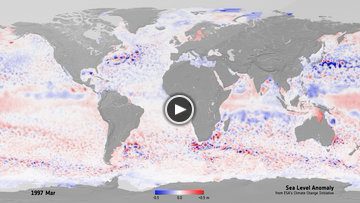
Sea Level Anomaly
Sea level (or sea surface height) is the level of the surface of the oceans, which varies across the
oceans due to circulation and currents, ocean topography, and can also rise (or fall) due to global
warming (or cooling). The CCI Sea Level project generates long-term sea level change and sea level
anomalies products at global scales.
|
Sea Ice Minima 3D
Polar sea ice is both an indicator and a driver of global climate change. Using satellite data
over the last several decades we can directly monitor its concentration, area, extent and its thickness.
|
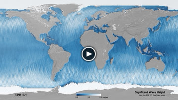
Seastate Significant Wave Height
Sea state is the statistical description of wind-generated ocean wave properties, including their
height, period, and direction. The CCI Sea State project generates long-term mean significant wave
height data from multiple satellite sensors.
|
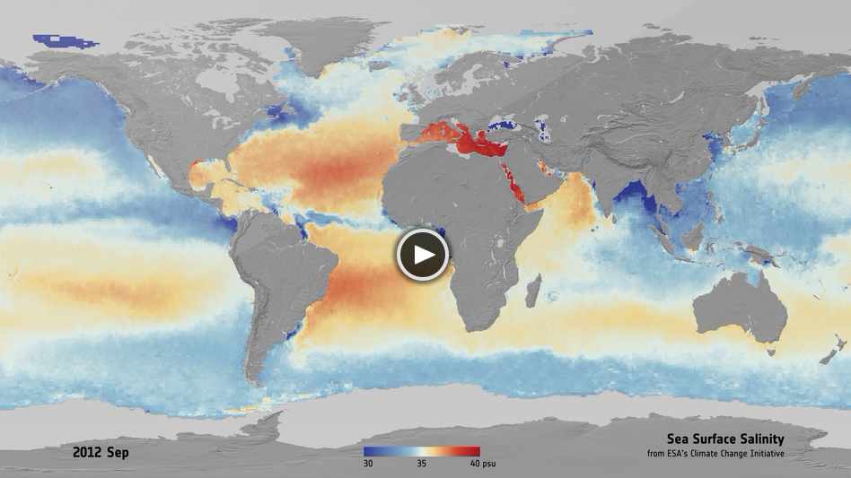
Sea Surface Salinity
The salinity of seawater is defined as the total amount by weight of dissolved salts in one kilogram of
seawater. Seawater salinity plays a key role in ocean circulation, the global water cycle and climate.
The CCI Sea Surface Salinity project generates global salinity maps.
|
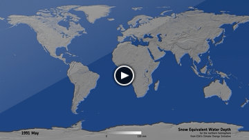
Snow Equivalent Water Depth
Snow is solid precipitation that occurs in a variety of small ice crystals at temperatures below 0°C and
as larger snowflakes at temperatures near 0°C. The CCI Snow project generates a long-term, global, daily
product of snow water equivalent, which indicates the amount of accumulated snow on land surfaces (i.e.,
the amount of water contained within the snowpack).
|
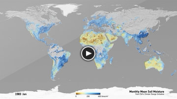
Monthly Mean Soil Moisture
Soil moisture is the amount of water stored in the soil and depends on factors such as precipitation,
temperature and soil characteristics. The CCI Soil Moisture project generages long-term, global daily
soil moisture data (% of saturation).
|
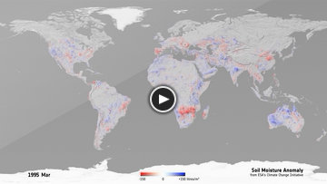
Soil Moisture Anomaly
Soil moisture is the amount of water stored in the soil and depends on factors such as precipitation,
temperature and soil characteristics.
The CCI Soil Moisture project generages long-term, global daily soil moisture data (% of saturation).
|
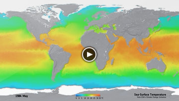
Sea-Surface Temperature
Sea surface temperature (SST) is the water temperature measured at the ocean's surface. The CCI SST
project produces a long-term, global and harmonised dataset of SST exploiting multiple satellite
instruments.
|
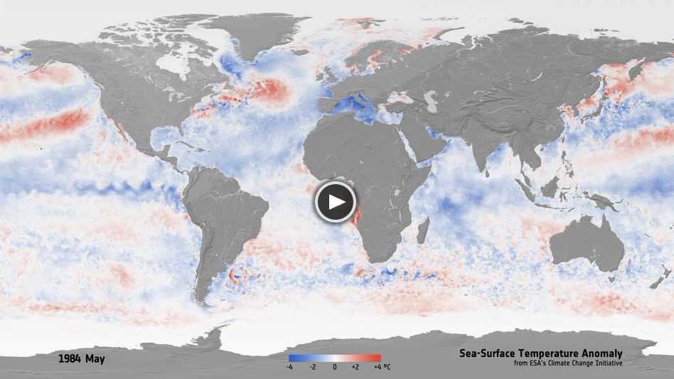
Sea Surface Temperature Anomaly
Sea Surface temperature (SST) is a vital component of the climate system as it exerts a major influence
on the exchanges of energy, momentum and gases between the ocean and atmosphere. The CCI Sea Surface
Temperature project aims to make climate data records for SST longer, more stable and more accurate.
|
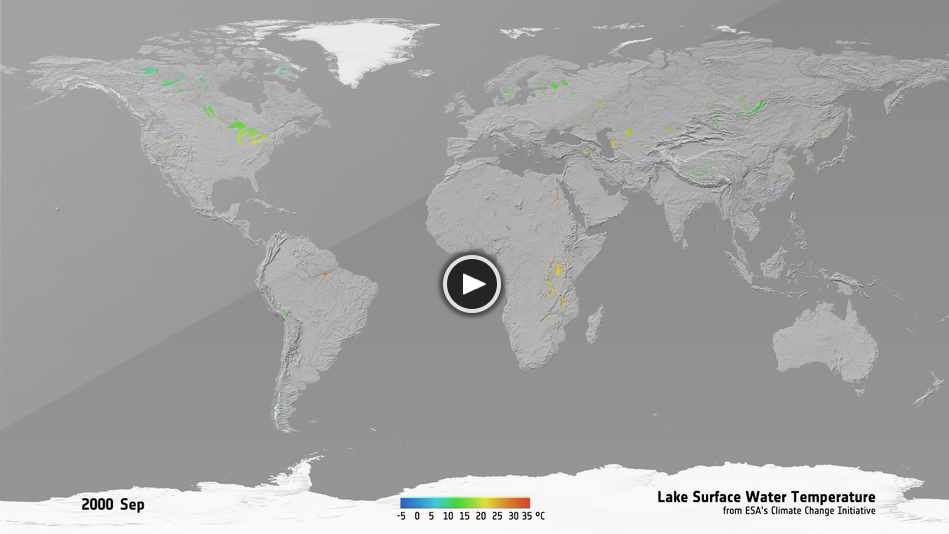
Lakes Surface Water Temperature
Lakes are sentinels of climate change at local and global scales. Ranging greatly in their ecological
characteristics, lake water bodies around the world play an important role in the water cycle and can be
affected in various ways by climate change. The CCI Lakes project is developing satellite-derived products
covering various aspects of lake characteristics, such as Lake Water Level, Lake Water Extent,
Lake Surface Water temperature, Lake Ice Cover and Lake Water-Leaving Reflectance.
|
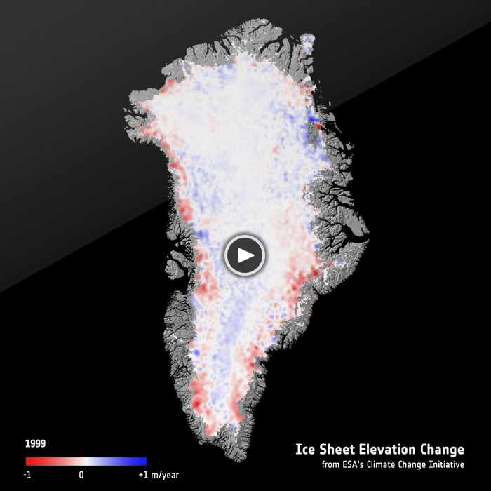
Icesheet Elevation Change
Over the last decade, the Greenland Ice Sheet has shown rapid change, characterised by rapid thinning
along the margins, accelerating outlet glaciers and overall increasing mass loss. The state of the
Greenland Ice Sheet is of global importance and the CCI Greenland Ice Sheets project produces data
products of five ECV parameters, which are catalytic in characterising the Greenland Ice Sheet.
|
| |
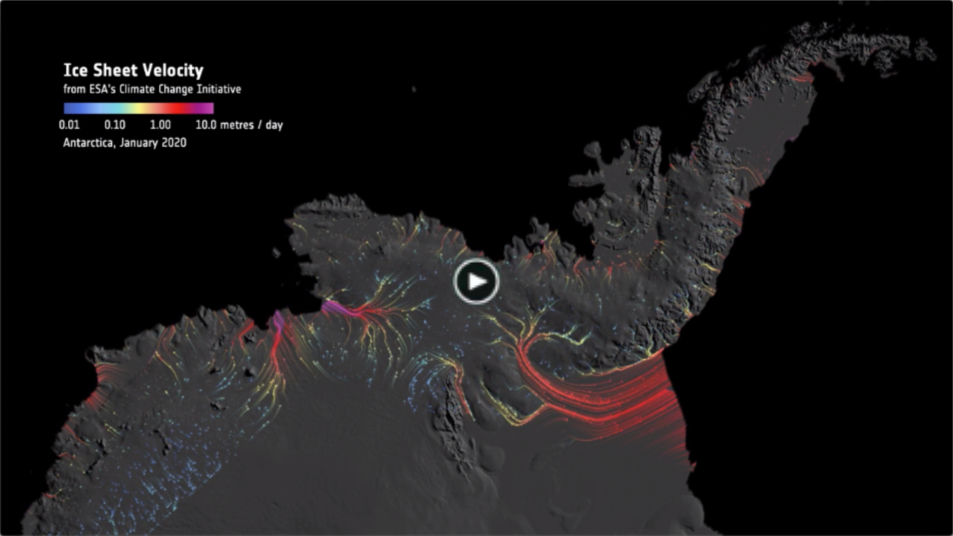
Ice Sheets Antarctic velocity
Providing key parameters of Antarctic ice sheet data to improve our understanding of historical
and present-day change in Antarctica, to assess the skill of the IPCC’s climate models,
and to improve the accuracy of climate projections.
|
|